Trotz der substanziellen Bedeutung von gewerblich genutzten Flächen rücken diese in der Stadtplanung häufig aus dem Fokus und werden zu „vergessenen Stadträumen“.
Das Projekt soll dieser Entwicklung entgegenwirken und das in der Fläche vorhandene Potenzial für sozialen Zusammenhalt sowie die hohe Lebens- und Umweltqualität entfalten.
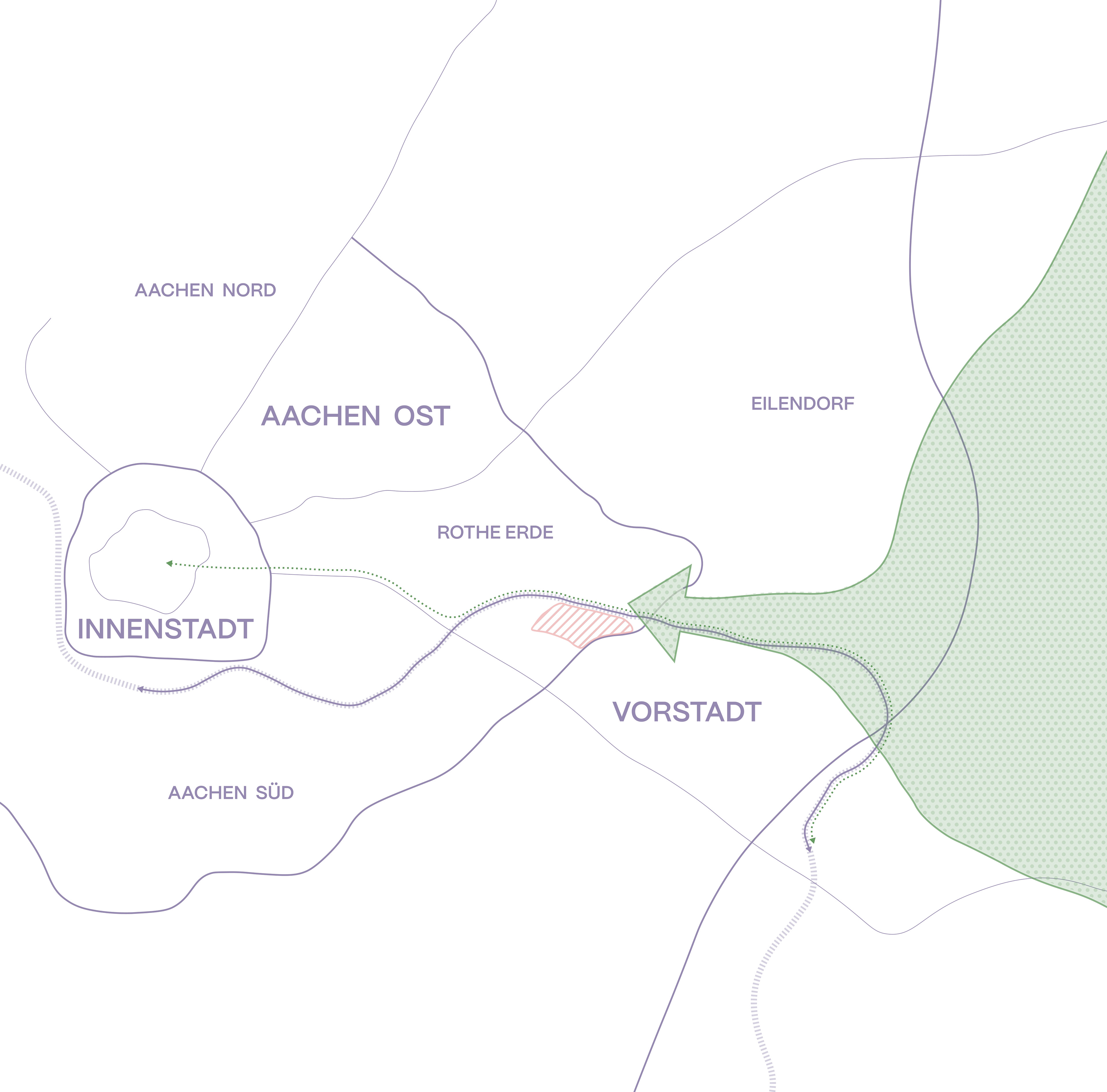
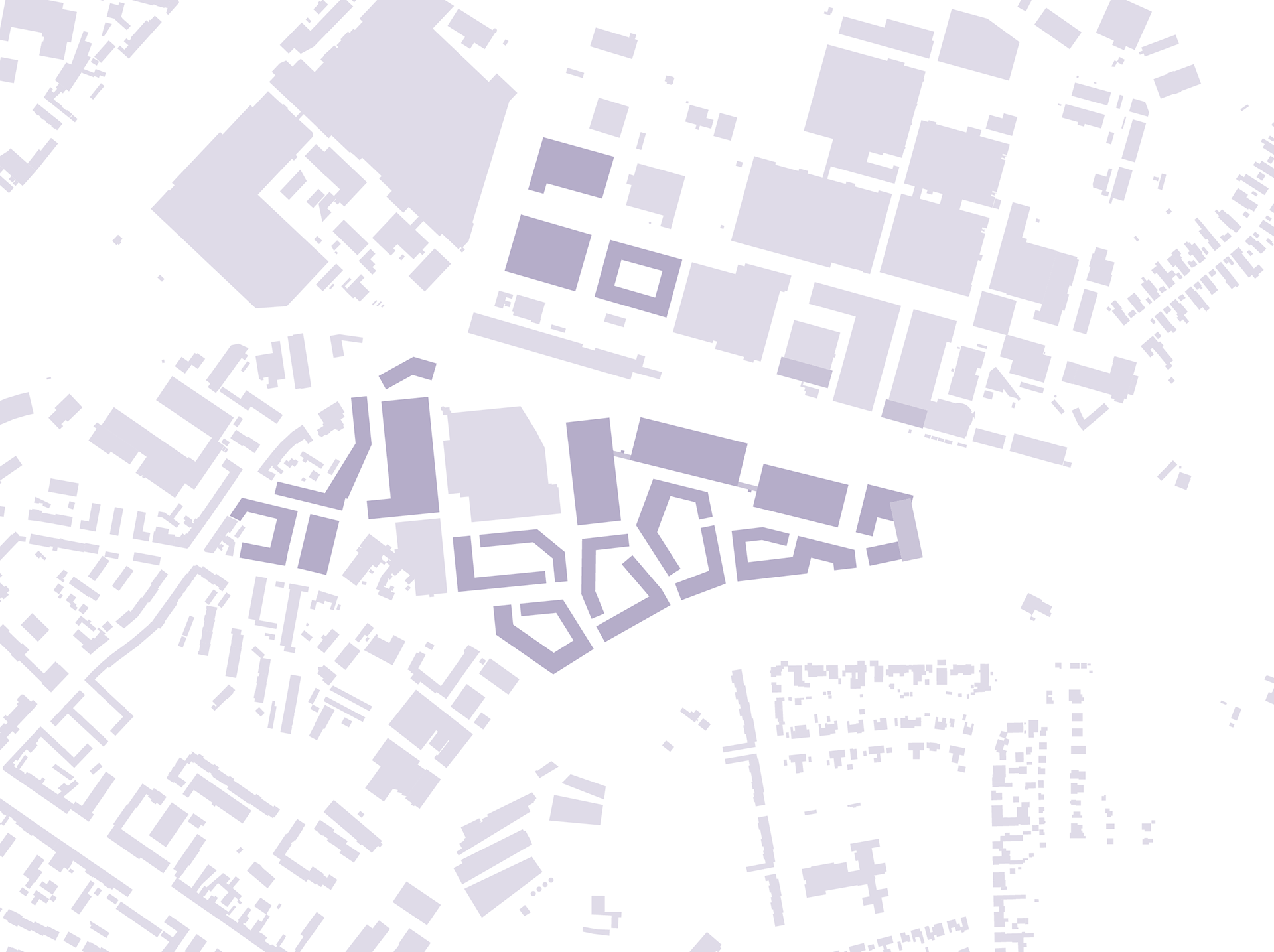
Das Plangebiet befindet sich in Aachen-Rothe Erde, wo das bislang als Gewerbegebiet genutzte Areal zunehmend im Entwicklungsfokus steht. Die Planung basiert auf der Idee eines hybriden Stadtquartiers, in dem Wohnen, Büro- und Gewerbeflächen vernetzt werden. Auf einem Nachbargrundstück wird bereits ein Areal unter ähnlichen Anforderungen von Architekturbüro „Molestina Architekten“ entwickelt.
Diese Planung fließt in die Konzeption dieses Projekts ein und verbindet die bislang introvertierten Gebiete rund um Aachen-Rothe Erde, wodurch ein heterogener Stadtteil entsteht.
Das Projekt soll dieser Entwicklung entgegenwirken und das in der Fläche vorhandene Potenzial für sozialen Zusammenhalt sowie die hohe Lebens- und Umweltqualität entfalten.
Das Plangebiet befindet sich in Aachen-Rothe Erde, wo das bislang als Gewerbegebiet genutzte Areal zunehmend im Entwicklungsfokus steht. Die Planung basiert auf der Idee eines hybriden Stadtquartiers, in dem Wohnen, Büro- und Gewerbeflächen vernetzt werden. Auf einem Nachbargrundstück wird bereits ein Areal unter ähnlichen Anforderungen von Architekturbüro „Molestina Architekten“ entwickelt.
Diese Planung fließt in die Konzeption dieses Projekts ein und verbindet die bislang introvertierten Gebiete rund um Aachen-Rothe Erde, wodurch ein heterogener Stadtteil entsteht.
Despite the substantial importance of commercially used areas, they are oftenDespite the substantial importance of commercially utilised areas, they are often neglected in urban planning and become ‘forgotten urban spaces’.
The project aims to counteract this trend and realise the area‘s potential for social cohesion and the high quality of life and environment.
The planning area is located in Aachen-Rothe Erde, where the area previously used as an industrial estate is increasingly the focus of development. The planning is based on the idea of a hybrid urban neighbourhood in which residential, office and commercial space are interlinked. An area with similar requirements is already being developed on a neighbouring plot by the architectural firm ‘Molestina Architekten’.
This planning is being incorporated into the design of this project and will connect the previously introverted areas around Aachen-Rothe Erde, creating a heterogeneous neighbourhood.
Großraumanalyse area analysis
Isometrie Kreislaufwirtschaft isometric circular economy
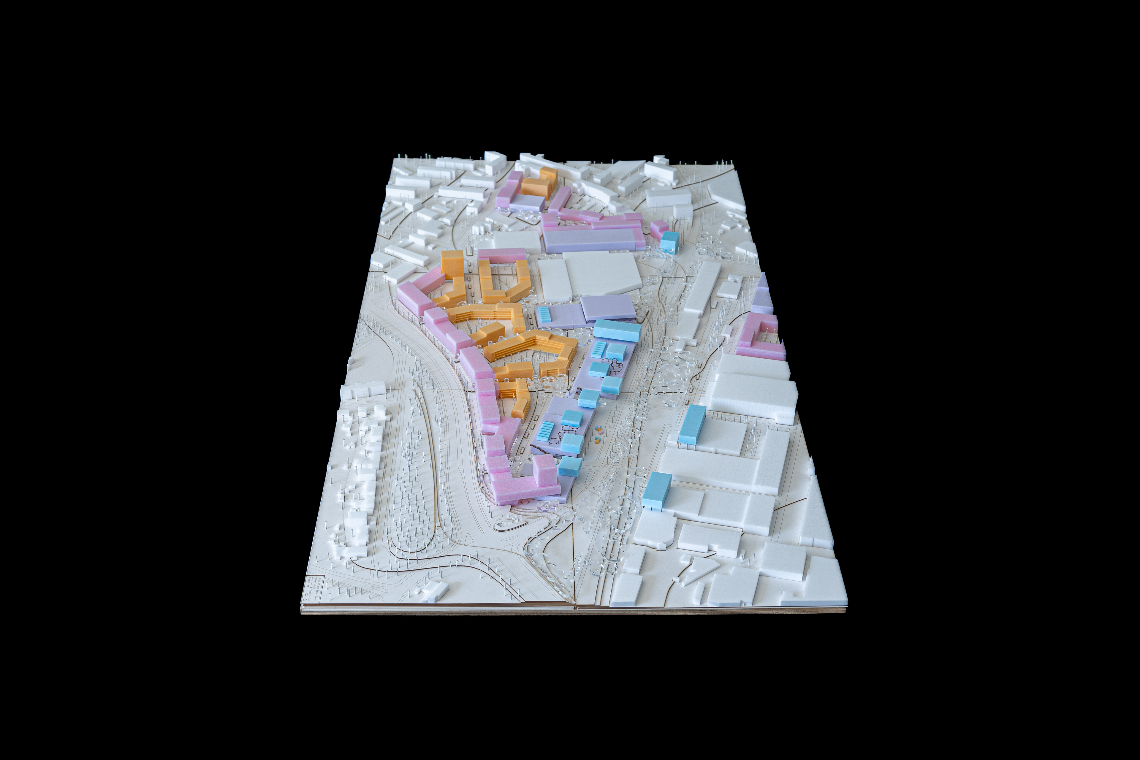
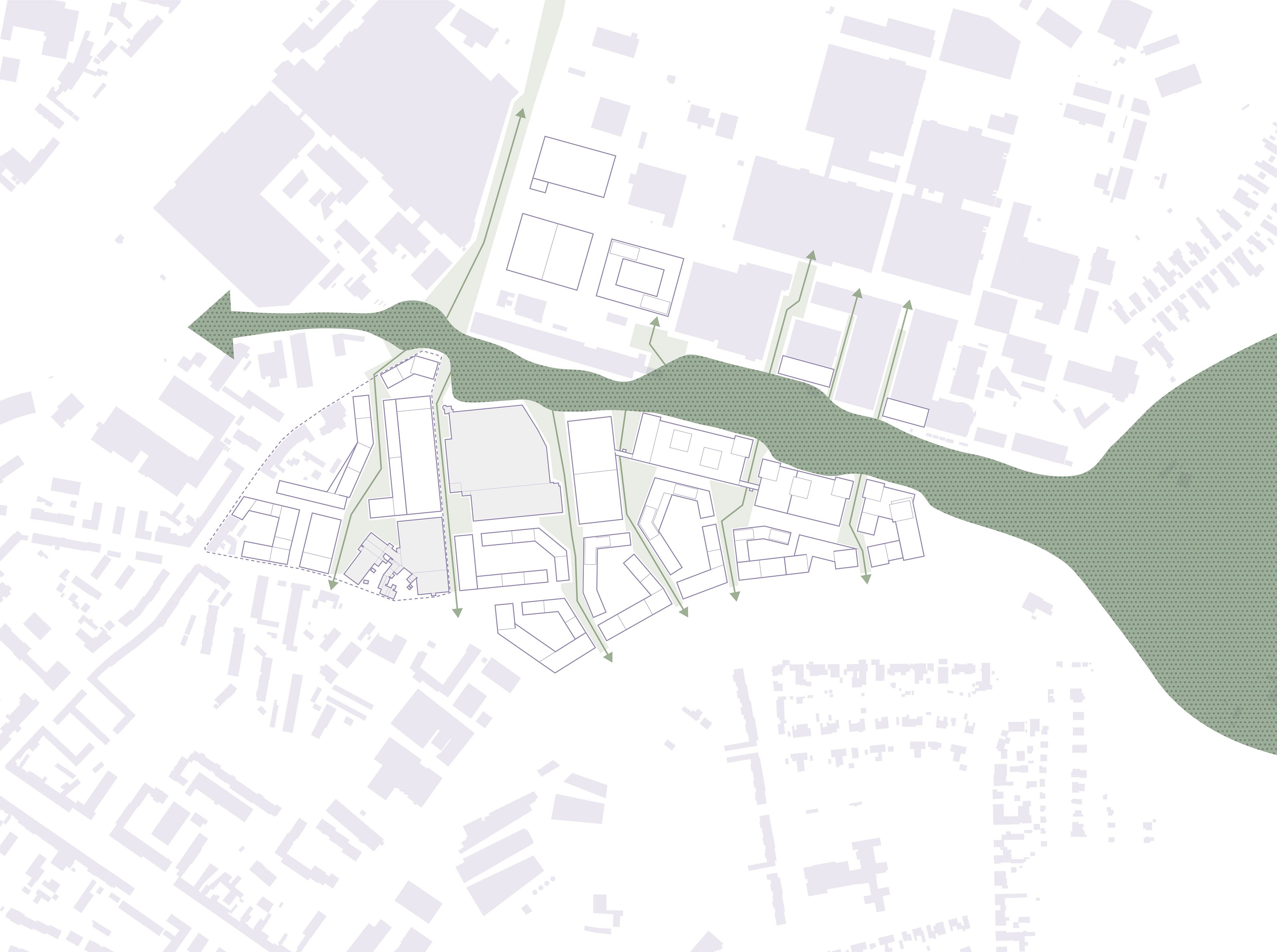
Strukturplan structureplan
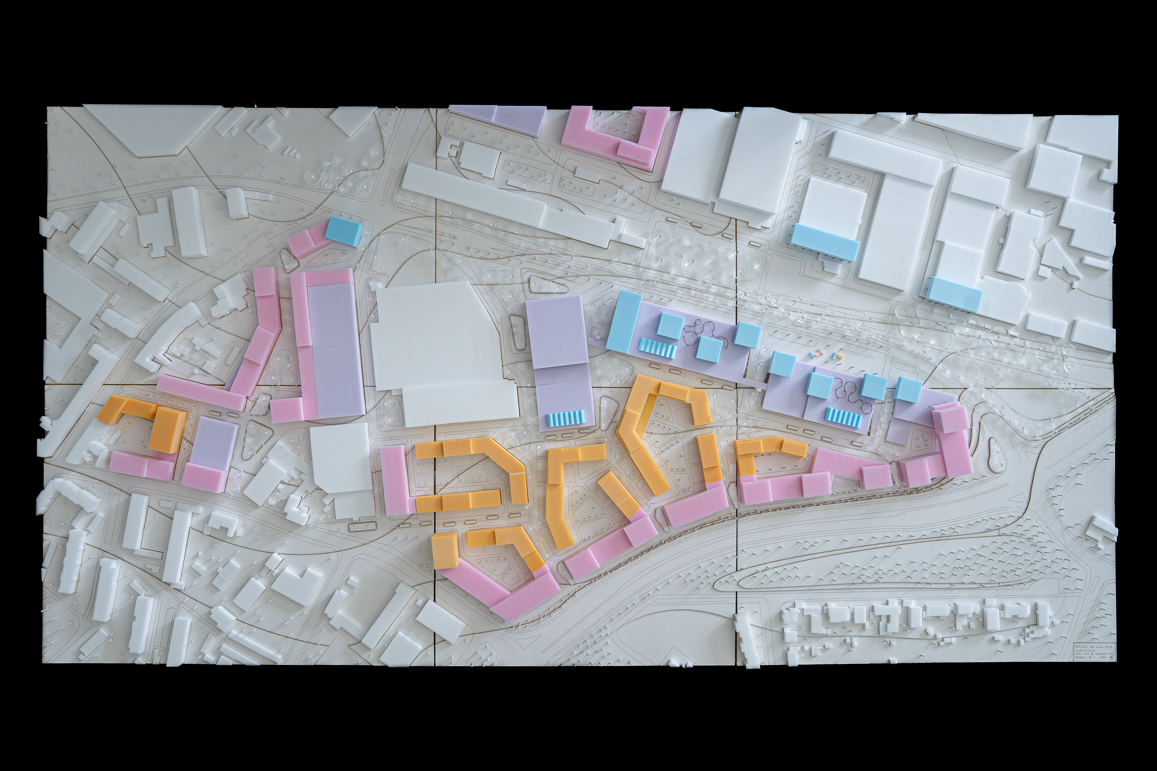
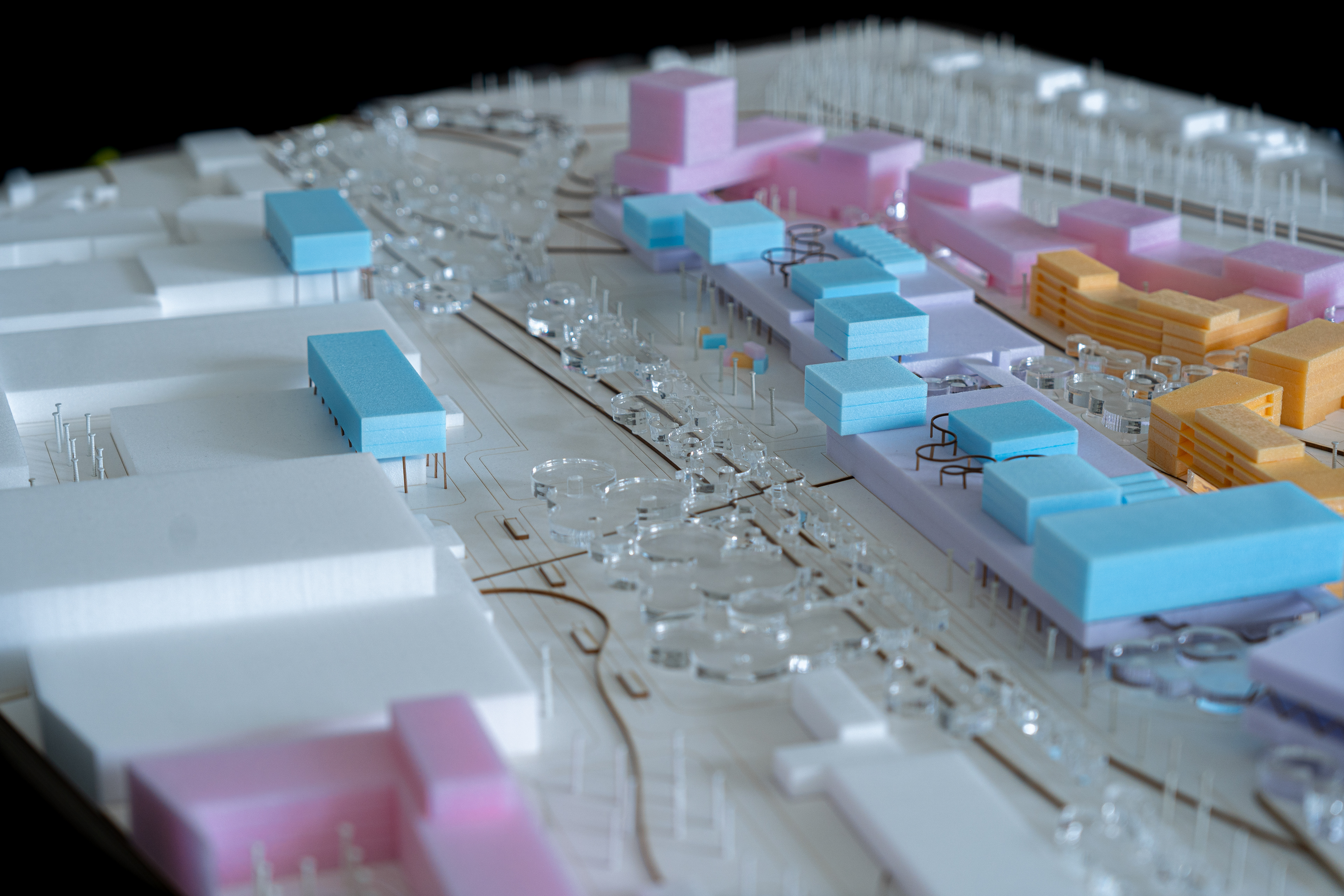
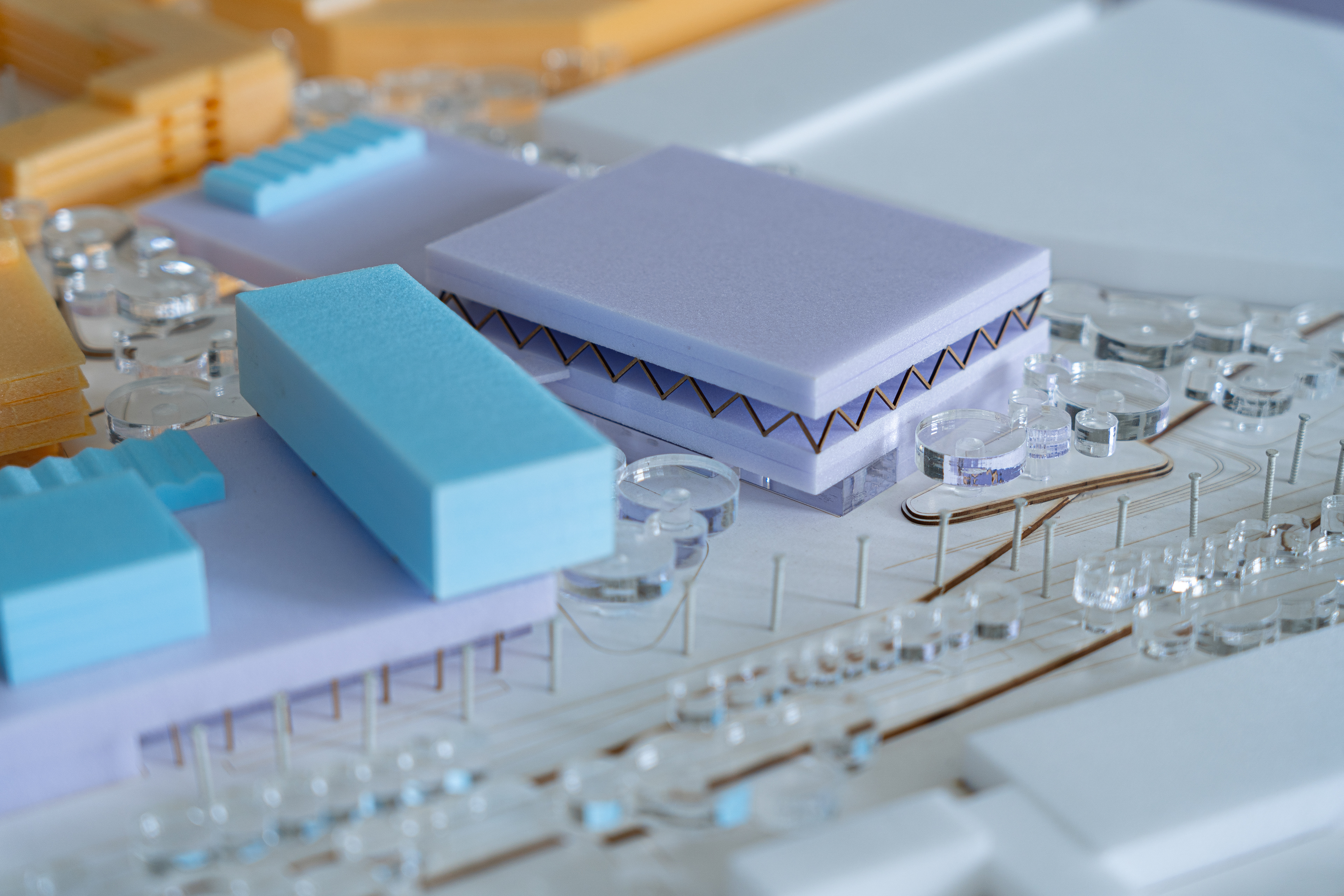
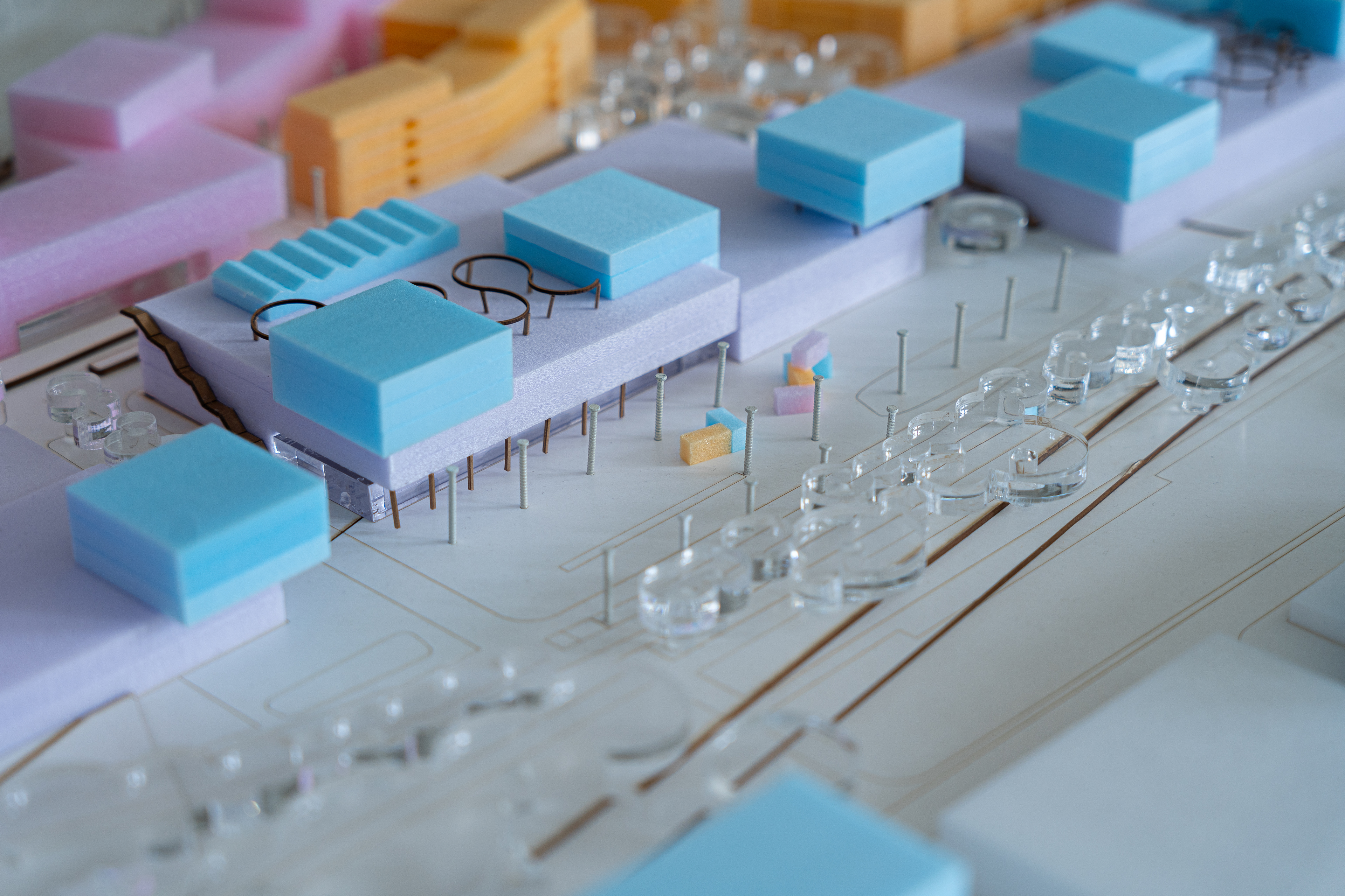
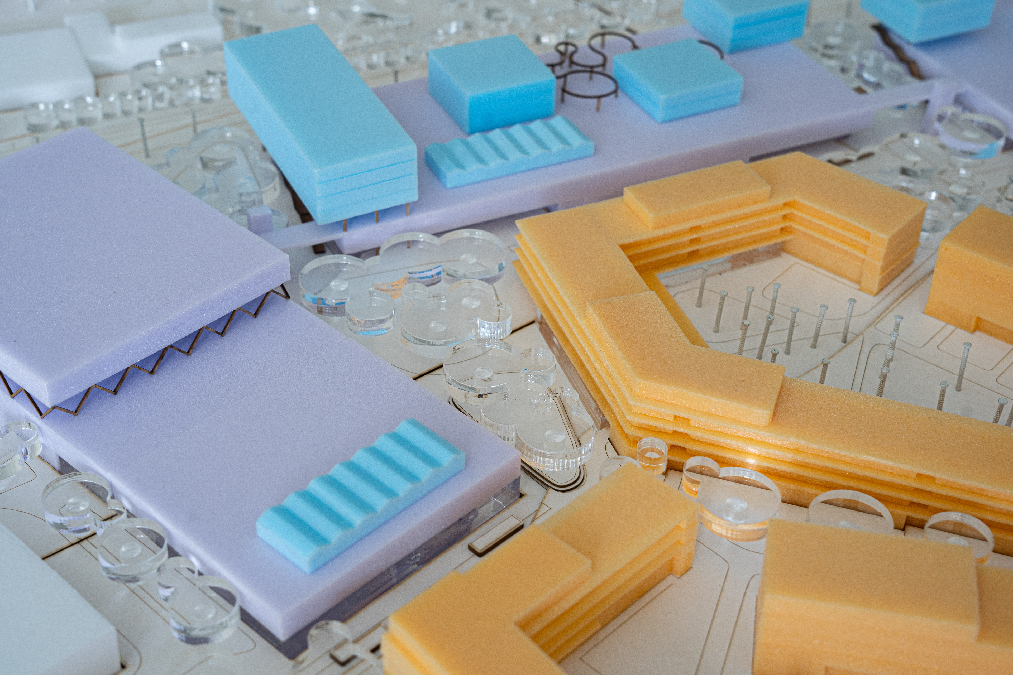
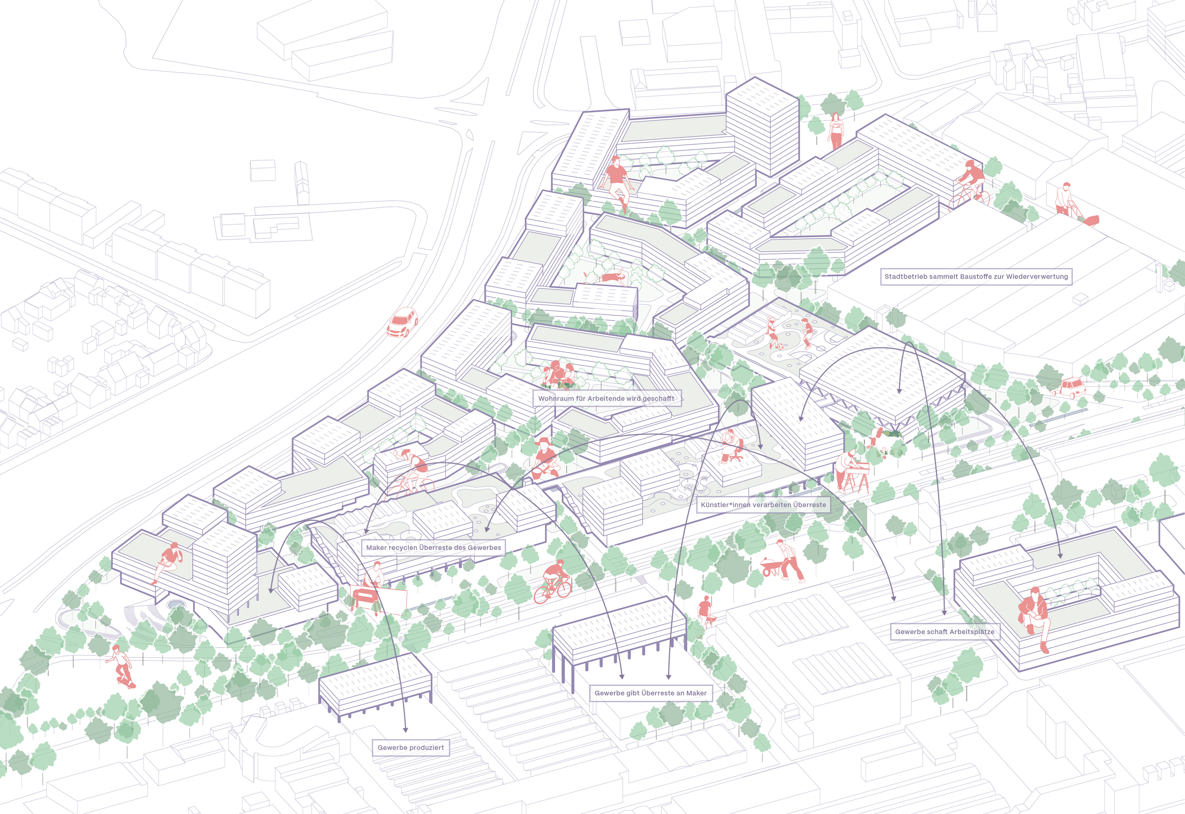
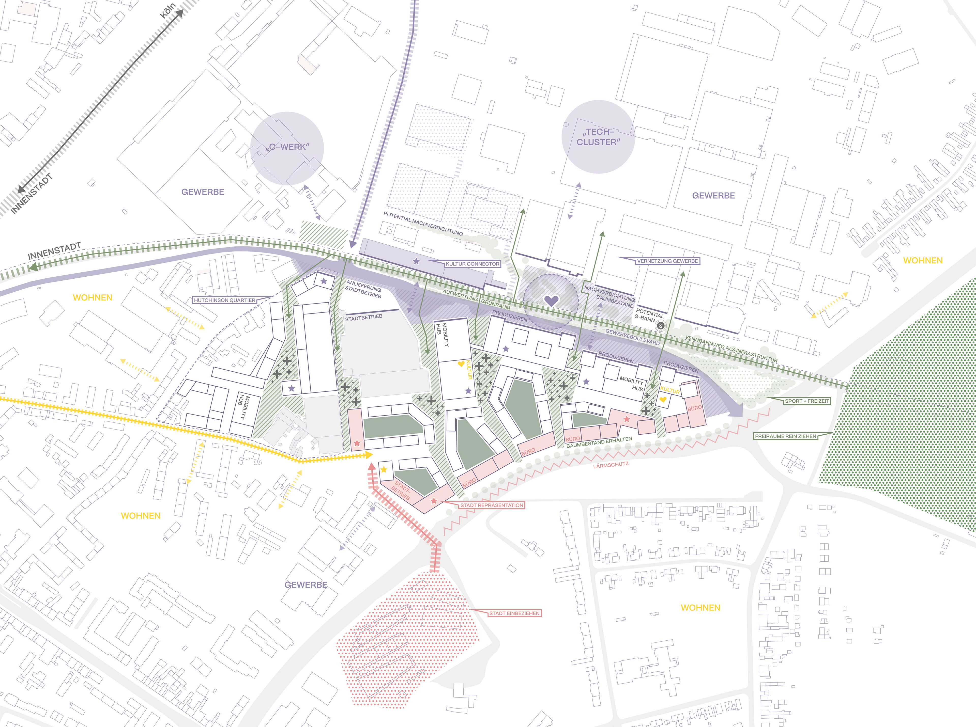
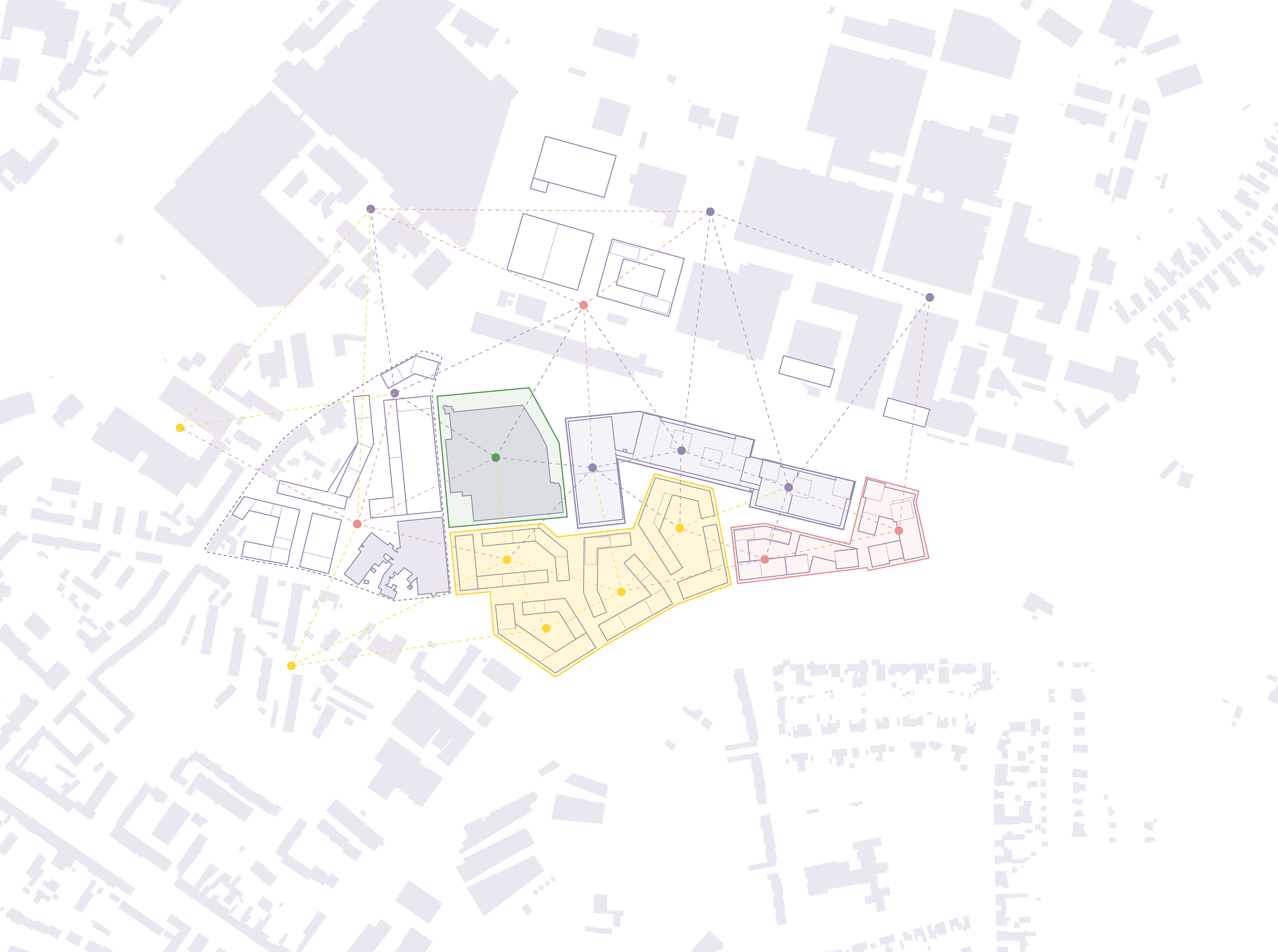
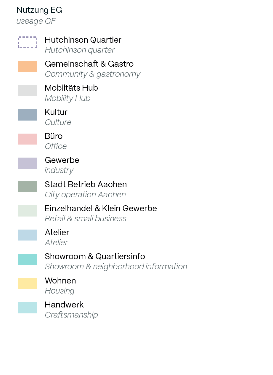
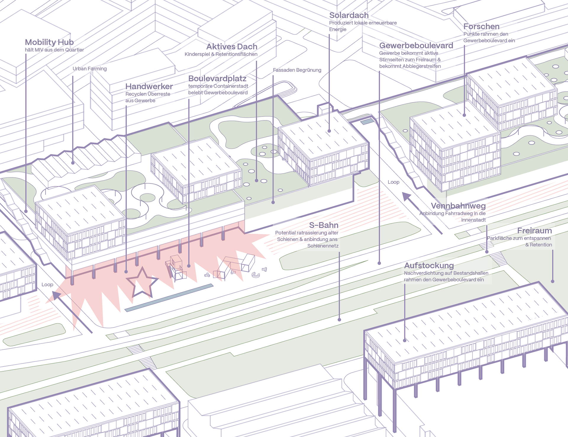
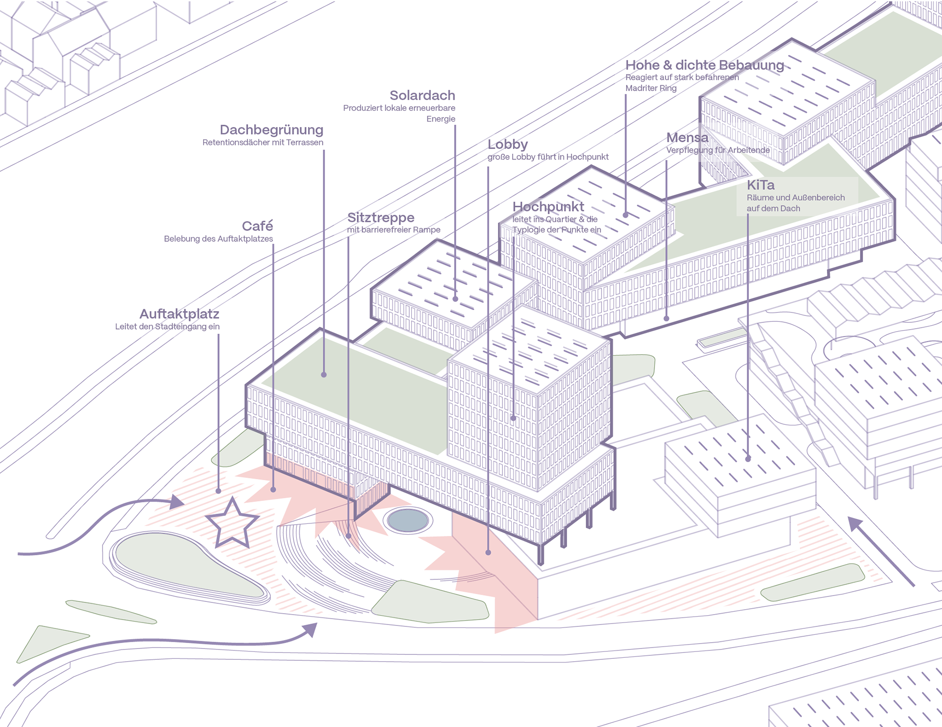
Das Plangebiet verbindet die Fahrradtrasse „Vennbahnweg“ im Norden mit dem lärmbelasteten Madrider Ring im Süden und einem Wohngebiet im Westen. Ein grüner Arm, der aus dem ländlichen Bereich vor Aachen auf das Plangebiet trifft, lässt den Grünraum seifenblasenartig in das Gebiet fließen. Der Eisenbahnweg wird mit einer grünen Mittelspur aufgewertet und vernetzt das Plangebiet mit dem Gewerbegebiet, sodass ein Gewerbeboulevard entsteht. Das Gebiet wird durch Kreislaufwirtschaft vernetzt. Die Baufelder sind in Gewerbe, Büro und Wohnraum unterteilt.
The plan area connects the ‘Vennbahnweg’ cycle route in the north with the noisy Madrider Ring in the south and a residential area in the west. A green arm, which meets the plan area from the rural area outside Aachen, allows the green space to flow into the area like a soap bubble. The railway track is upgraded with a green central lane and links the plan area with the commercial area, creating a commercial boulevard. The area will be linked by a circular economy. The building plots are divided into commercial, office and residential areas.


Lageplan siteplan
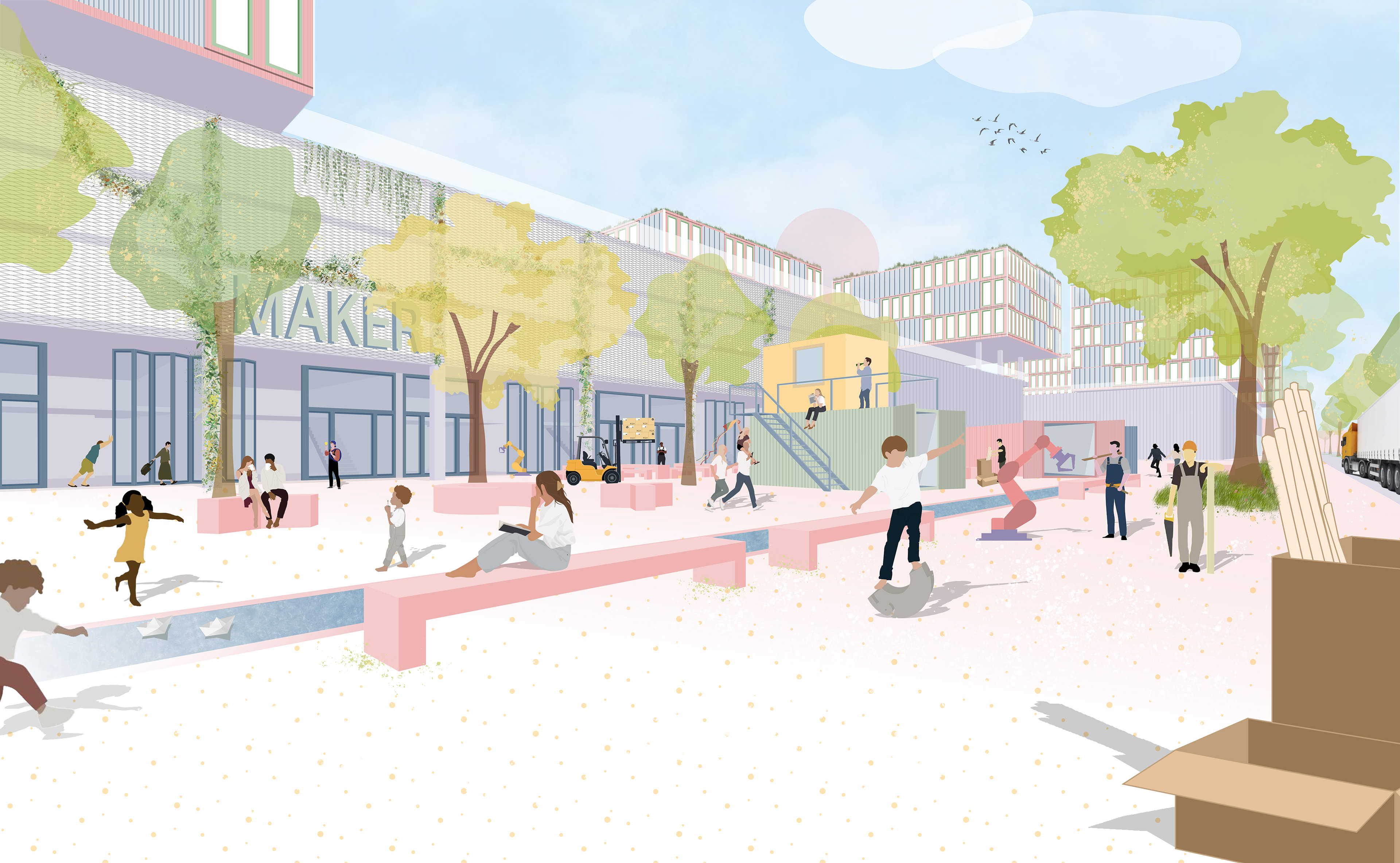
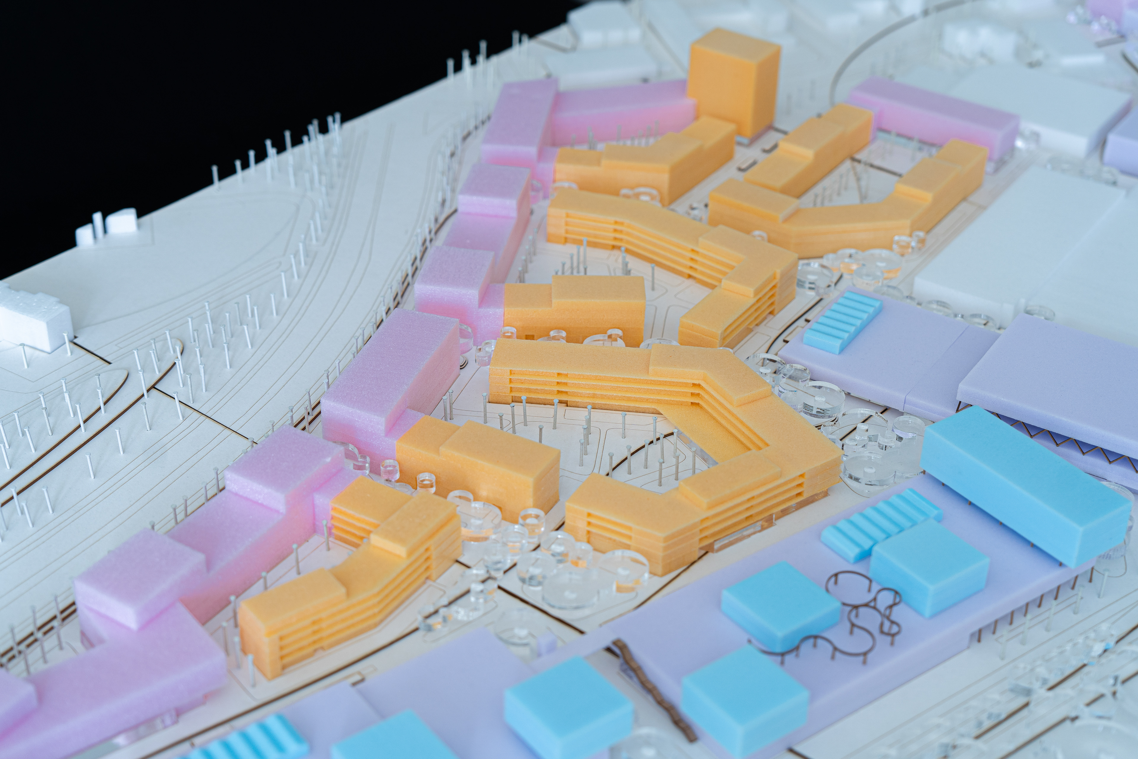
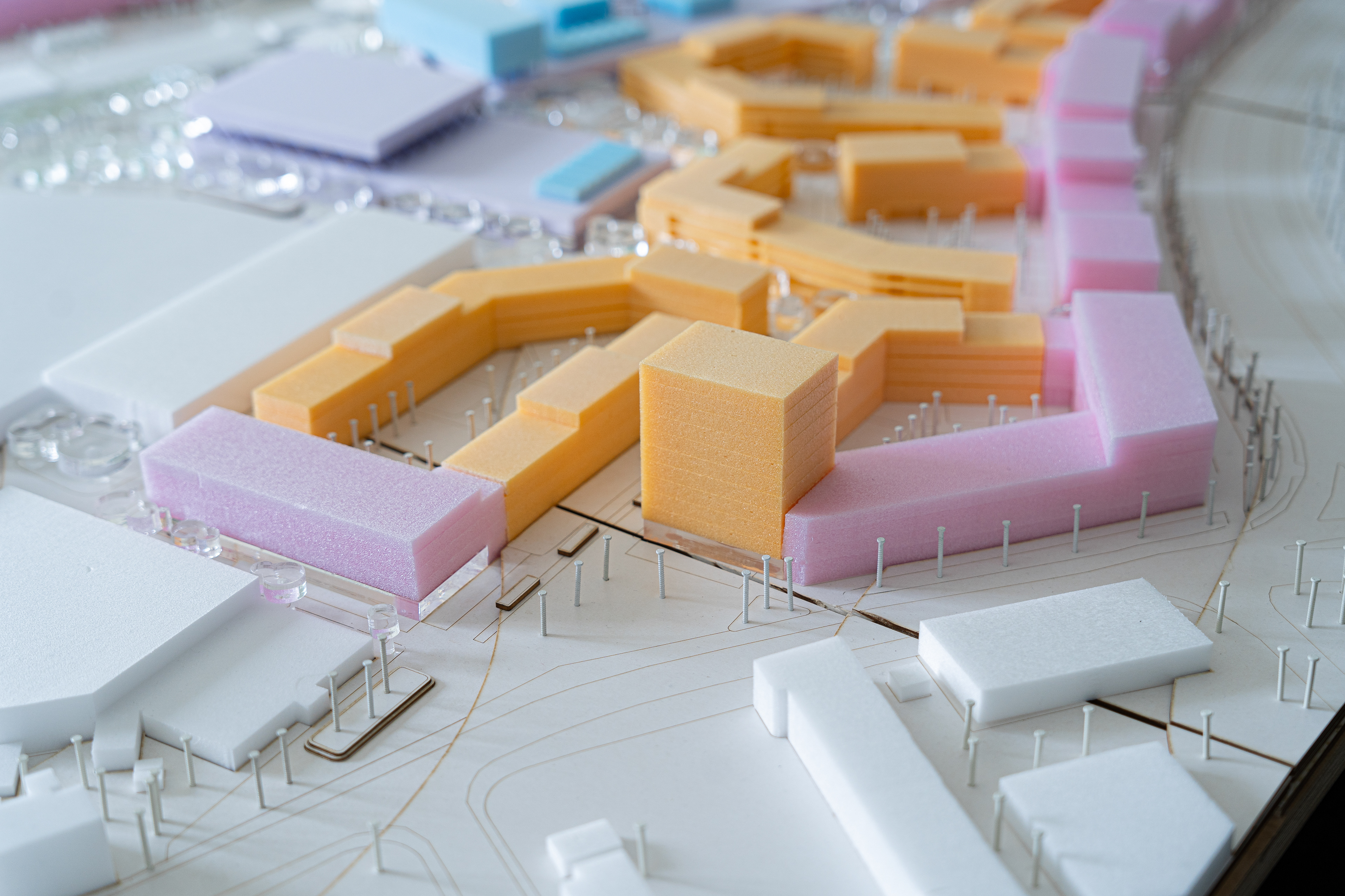
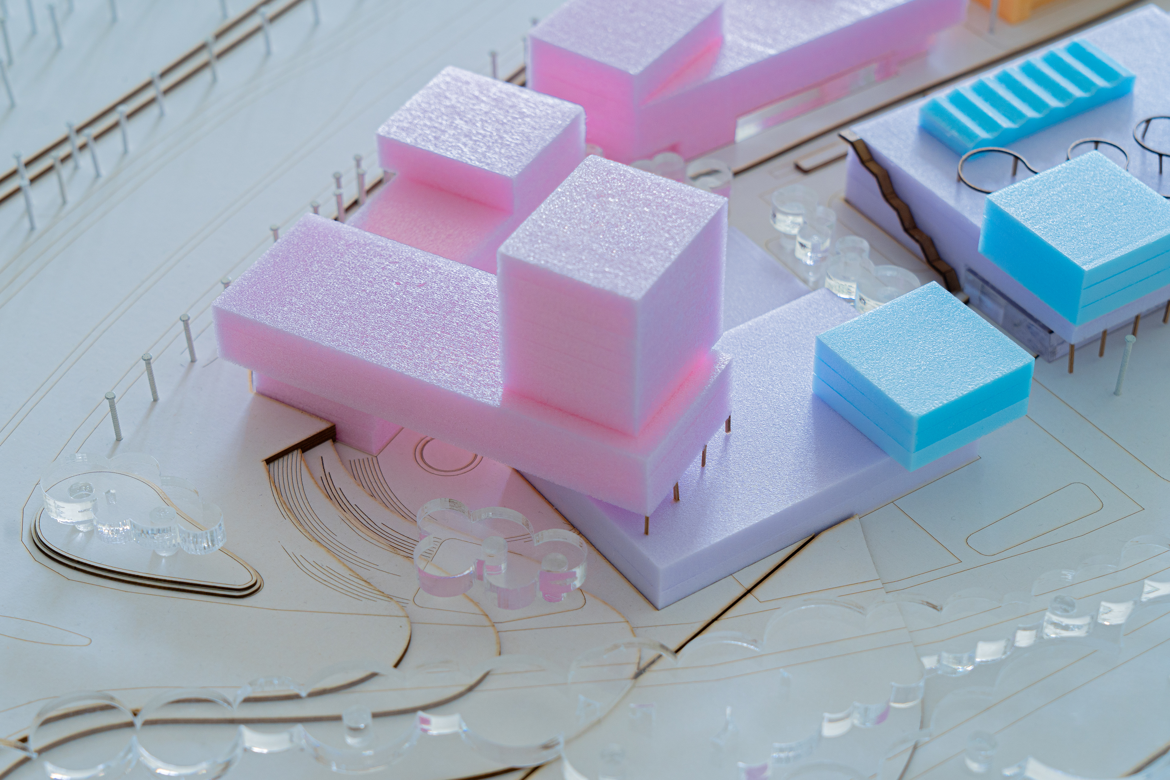
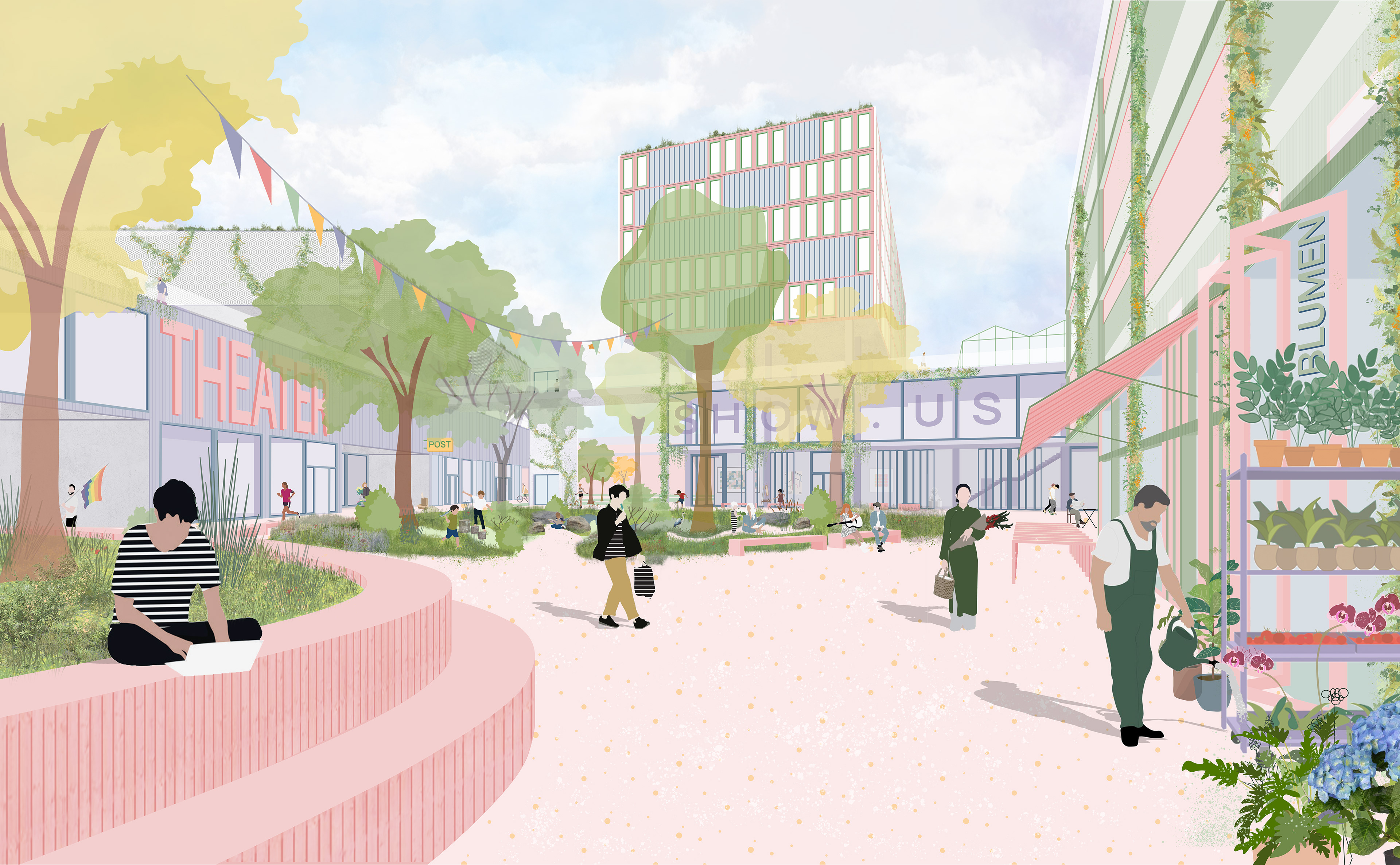
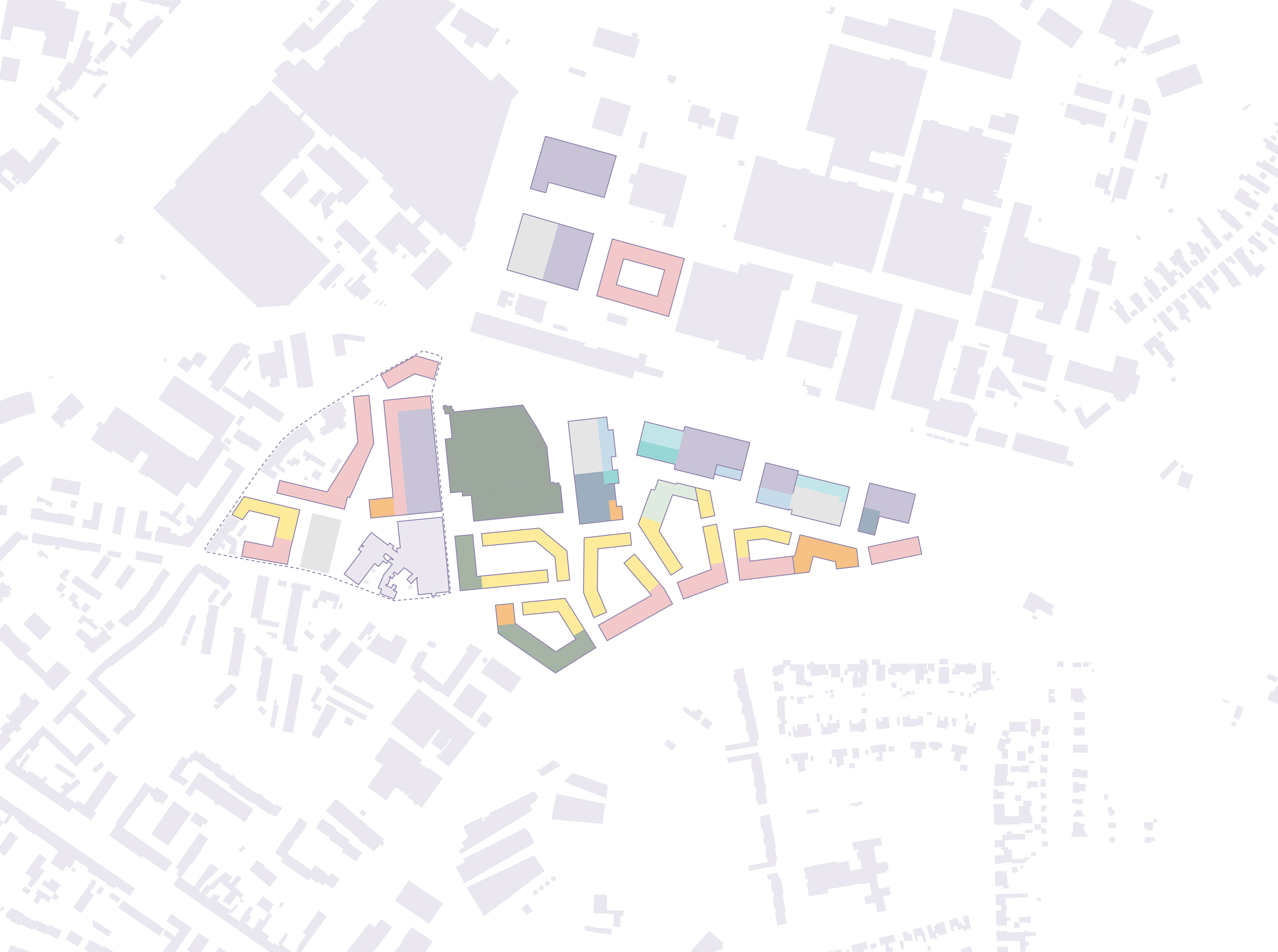
Die „Schiffe“ im Norden bieten Raum für Gewerbe, Handwerk und Mobilitätshubs. Ihre durch Brücken verbundenen Dächer umfassen Spielplätze, Urban-Farming und Forschungspunkte. Der Osteingang wird durch einen 13-geschossigen Büroturm markiert. Weitere Bürogebäude dienen zur Abschirmung des Lärms durch den Madrider Ring. Das Wohnangebot umfasst Maisonetten und 1- bis 5-Zimmerwohnungen, zugänglich über Laubengänge. Eine Blocktypologie trennt öffentliche und private Bereiche, während Innenhöfe die soziale Integration fördert.
The ‘ships’ in the north offer space for commerce, crafts and mobility hubs. Their roofs, connected by bridges, include playgrounds, urban farming and research centres. The eastern entrance is marked by a 13-storey office tower. Further office buildings serve to shield the noise from the Madrider Ring. The residential offer includes maisonettes and 1- to 5-room flats, accessible via arcades. A block typology separates public and private areas, while inner courtyards promote social integration.

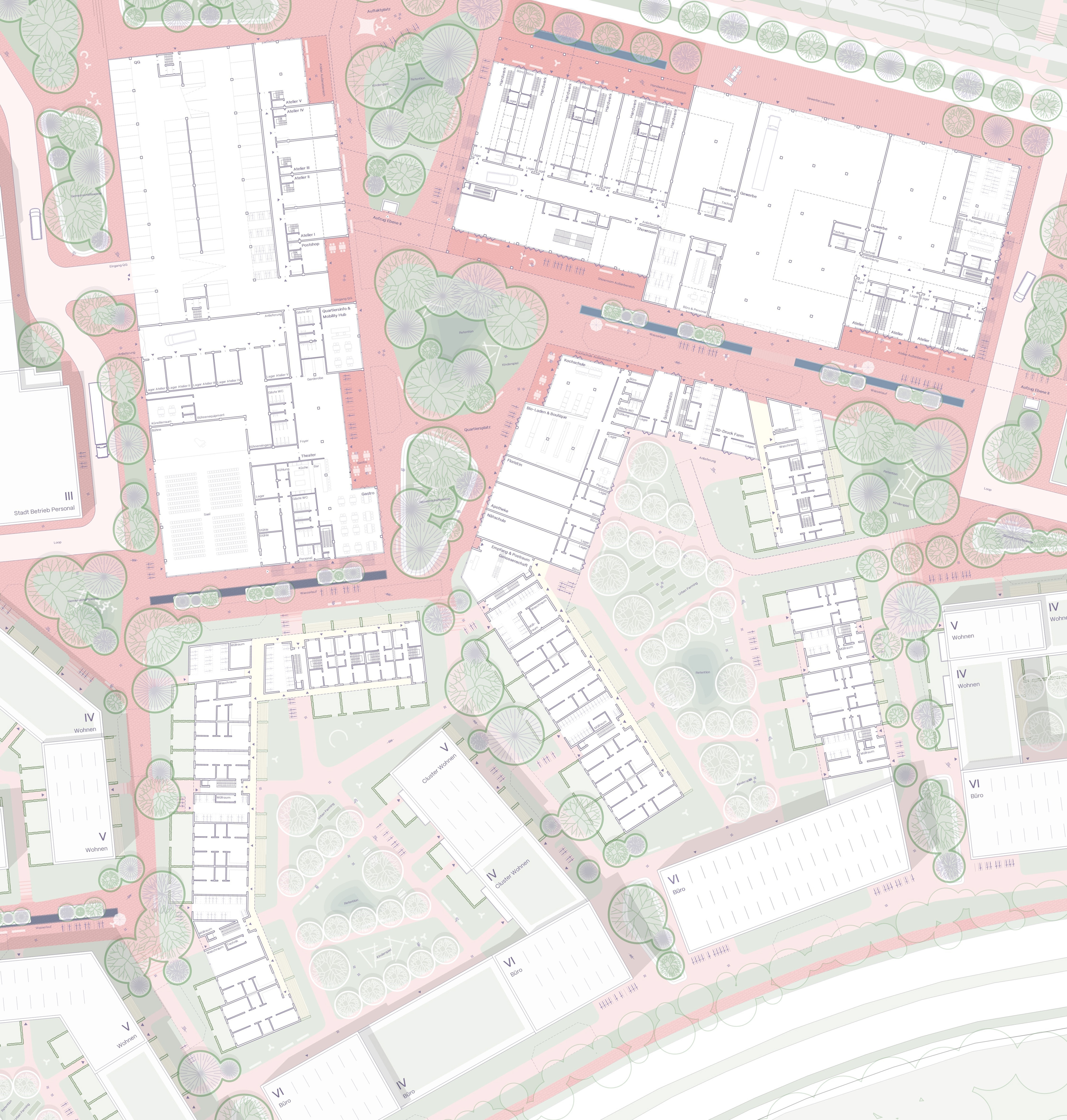
Grundriss EG floorplan GF
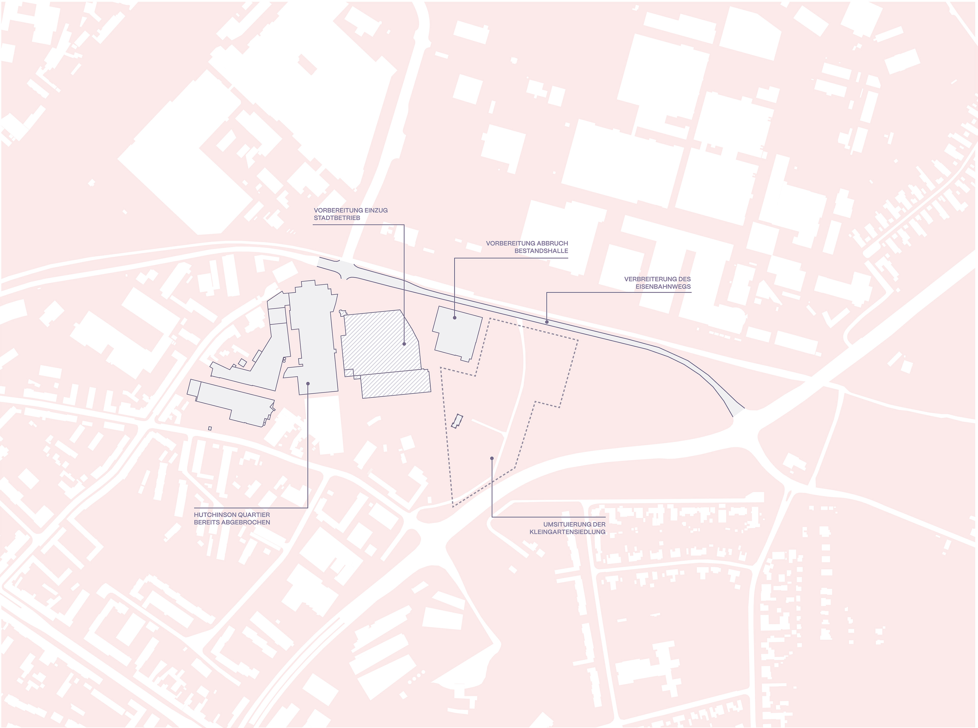
Die Umsetzung des Entwurfes im Plangebiet lässt sich in drei Phasen planen:
In Phase eins wird der Eisenbahnweg verbreitert, die Kleingartensiedlung umgesiedelt und das Hutchinson-Quartier zurückgebaut.
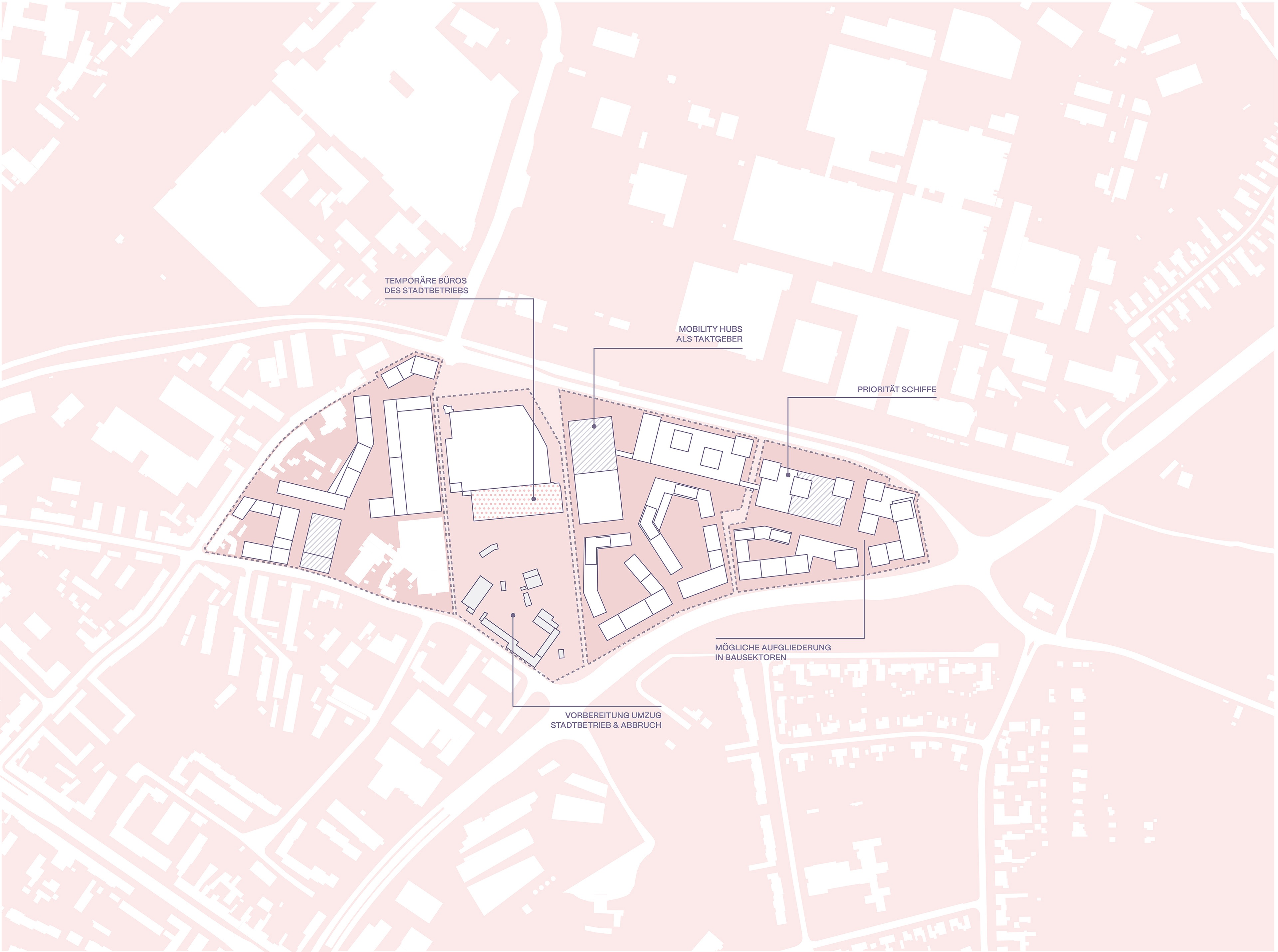
In Phase zwei beginnt der Bau des Areals beginnend mit den „Schiffen“ am Gewerbeboulevard und die Einrichtung temporärer Büros in der Gateshalle.
In Phase drei erfolgt die Nachverdichtung auf dem Bauhofareal. Der Stadtbetrieb zieht in die Gateshalle und bestehende Hallen im Gewerbegebiet werden aufgestockt.
In Phase eins wird der Eisenbahnweg verbreitert, die Kleingartensiedlung umgesiedelt und das Hutchinson-Quartier zurückgebaut.
In Phase zwei beginnt der Bau des Areals beginnend mit den „Schiffen“ am Gewerbeboulevard und die Einrichtung temporärer Büros in der Gateshalle.
In Phase drei erfolgt die Nachverdichtung auf dem Bauhofareal. Der Stadtbetrieb zieht in die Gateshalle und bestehende Hallen im Gewerbegebiet werden aufgestockt.
The realisation of the design in the plan area can be planned in three phases:
In phase one, the railway path will be widened, the allotment site relocated and the Hutchinson neighbourhood demolished.
In phase two, the construction of the site will begin with the ‘ships’ on the commercial boulevard and the installation of temporary offices in the Gateshalle.
In phase three, redensification will take place on the building yard site. The municipal company moves into the Gateshalle and existing halls in the industrial estate are extended.v